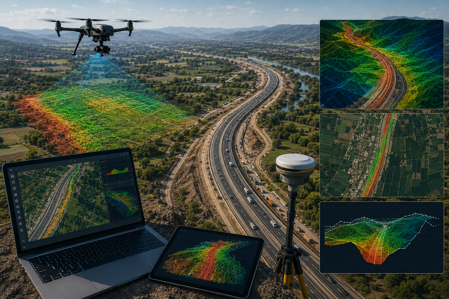
Highway Corridor Mapping & Digital Survey Execution
Integrated drone mapping, DGPS RTK survey, and GIS-based spatial analysis for transportation corridor planning, alignment review, and engineering support.
Explore selected infrastructure, mining, geospatial, drone, and GIS projects executed with field-grade accuracy, technical discipline, and spatial intelligence workflows built for real-world environments.
A curated set of field-based assignments delivered using drone mapping, DGPS RTK, LiDAR processing, hydrographic methods, and GIS analysis for infrastructure and industrial planning.
Integrated drone mapping, DGPS RTK survey, and GIS-based spatial analysis for transportation corridor planning, alignment review, and engineering support.
Topographic capture and terrain interpretation for mine planning, volume assessment, and operational decision-making in active field conditions.
Depth profiling and water-body mapping used for hydraulic assessment, navigation support, and water resource planning.
Advanced geospatial workflows combining LiDAR processing, contour mapping, and spatial intelligence for infrastructure planning and asset analysis.
SATMOS Infra Tech delivers field-grade surveying, mapping, GIS, drone, and infrastructure intelligence solutions for large-scale industrial, infrastructure, and development projects.
Corridor alignment mapping, topographic survey, and infrastructure planning support for highways, bridges, and transportation projects.
Mine surveying, terrain modeling, volumetric analysis, and GIS intelligence for operational planning and excavation monitoring.
Rail corridor mapping, alignment verification, spatial analysis, and infrastructure survey support for rail development projects.
Hydrographic and bathymetric surveys for reservoirs, rivers, channels, and water infrastructure planning operations.
GIS mapping, LiDAR workflows, and geospatial intelligence for urban planning and smart development ecosystems.
Surveying and spatial data support for transmission corridors, utility infrastructure, and industrial energy projects.
Combining modern field equipment, drone systems, GIS intelligence, and geospatial workflows to deliver highly accurate engineering and infrastructure data.
SATMOS integrates drone mapping, DGPS RTK, GIS analysis, LiDAR workflows, and hydrographic systems to generate high-accuracy infrastructure intelligence for large-scale projects.
Orthomosaic mapping, aerial inspection, terrain modeling, and corridor analysis.
High-accuracy positioning systems for engineering and infrastructure surveys.
Spatial analysis, thematic mapping, and geospatial data management systems.
Point cloud processing, contour extraction, and terrain classification workflows.
Every SATMOS project follows a disciplined operational framework combining field execution, spatial intelligence, data validation, and engineering-grade deliverables.
Understanding terrain conditions, project objectives, infrastructure scope, and technical deliverable requirements.
Mobilization of DGPS RTK systems, drone platforms, hydrographic equipment, and technical survey teams.
Capturing highly accurate geospatial, topographic, bathymetric, and terrain intelligence data sets.
Orthomosaic generation, contour extraction, LiDAR processing, and advanced GIS analysis workflows.
Cross-verification, coordinate validation, and engineering-grade accuracy assessment procedures.
Delivery of GIS outputs, engineering drawings, terrain models, maps, reports, and spatial datasets.
SATMOS Infra Tech continues to deliver large-scale surveying, GIS, drone, LiDAR, and infrastructure intelligence operations across multiple engineering sectors.
Corridor mapping, terrain analysis, hydrographic surveys, drone intelligence, and DGPS-based engineering operations executed with high-accuracy workflows.
Infrastructure, mining, geospatial, and engineering survey operations executed.
Precision-driven field validation and engineering-grade spatial verification workflows.
Survey engineers, GIS analysts, drone operators, and spatial intelligence professionals.
Infrastructure, mining, railways, utilities, hydrographic, and smart development.
SATMOS Infra Tech collaborates across infrastructure, mining, engineering, utility, and development sectors requiring highly accurate geospatial and surveying operations.
From infrastructure corridors and mining zones to hydrographic environments and smart infrastructure ecosystems, SATMOS delivers precision-focused field execution and geospatial intelligence.
Surveying and mapping support for roads, corridors, industrial parks, and civil infrastructure.
Terrain analysis, volumetric surveys, and geospatial intelligence for operational planning.
Infrastructure and spatial data solutions supporting public-sector engineering initiatives.
Corridor intelligence, survey execution, and mapping support for utility infrastructure.
Connect with SATMOS Infra Tech for drone surveying, GIS intelligence, LiDAR processing, infrastructure mapping, hydrographic surveys, and engineering-grade spatial solutions.